BikeRouter and OnRouteMap

Since following this year's transcontinental race and listening to the Sitzfleisch podcast by ultracycling professional Christoph Strasser and his peer Florian Kraschitzer, I became interested in long-distance cycling again. Planning long-distance cycling routes goes beyond simply connecting two points on a map. Besides finding a good route that balances distance and elevation gain, resupply is key. Food, water, and even spare parts must be planned for. Routes often require mapping out supermarkets, gas stations, or villages that can provide essential refueling points.
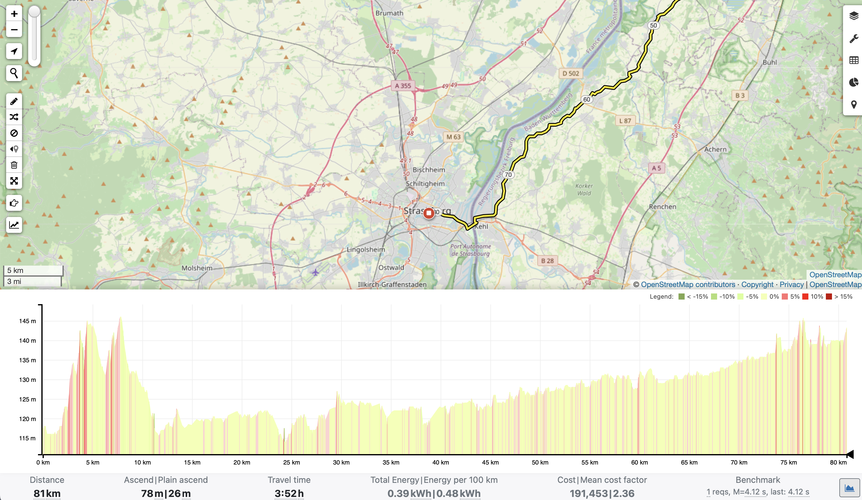
Bikerouter.de is an online tool for planning cycling routes with a strong focus on flexibility and detailed customization. At its core, it allows you to choose different routing profiles depending on the type of ride you are planning—whether that is road cycling, gravel, trekking, mountain biking, or simply the shortest or safest path between two points. For any route you calculate, the site can also suggest up to three alternatives, making it easy to compare different options before deciding which one fits your needs.
Routes can be built interactively by placing waypoints on the map, but you can also import existing tracks in formats like GPX, KML, or GeoJSON. Another powerful feature is the use of “no-go areas,” which can be drawn directly on the map or imported from a file; these tell the routing engine to avoid certain regions, such as busy roads or restricted trails. Once a route is ready, it can be exported in multiple formats—including GPX, FIT, CSV, and GeoJSON—or shared quickly through a shortlink or QR code.
The site does not just create routes; it also provides rich analysis. For every planned trip, Bikerouter.de shows key statistics such as distance, riding time, total ascent, maximum elevation, and a detailed elevation profile. There are even more advanced stats like “plain ascent” (which distinguishes flat from climbing sections) and energy estimates, which give a deeper understanding of how demanding the ride might be.
Behind the scenes, Bikerouter.de is powered by the BRouter routing engine with map data from OpenStreetMap and elevation data from sources like the CGIAR-CSI SRTM dataset.
OnRouteMap is a tool to plan better by finding useful stops along your route. You start by uploading a GPX file of your planned route. Once uploaded, the website identifies “points of interest” (POIs) such as supermarkets, cafés, public drinking water sources, bakeries, fast food spots, and more. Optional categories include bicycle repair shops, shelters, campsites, hotels, or other accommodations. All these are shown in proximity to the route.
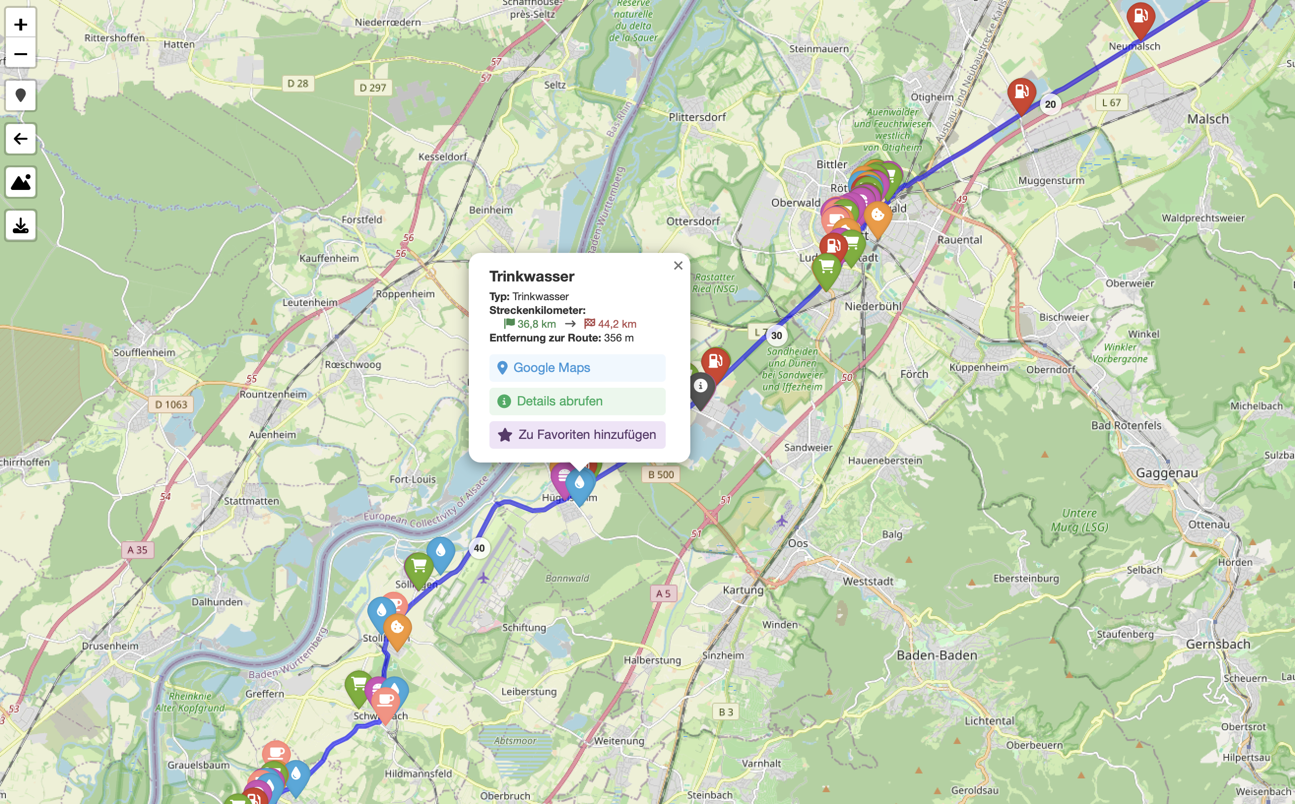
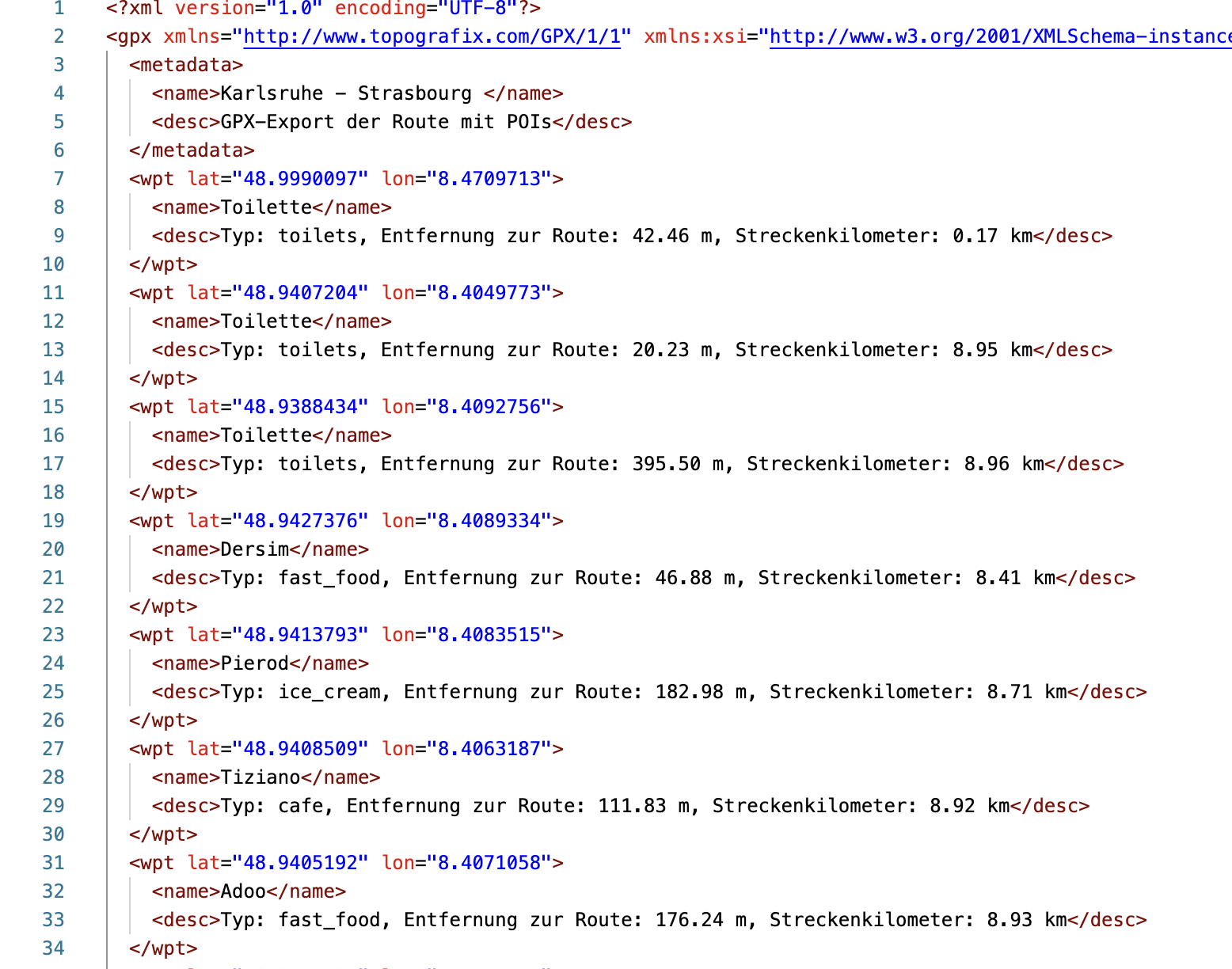
On top of that, you can download the GPX file again, now enriched with the points of interest (POIs), so that you can store it on your phone for offline use.
Similar Services
The discussion in r/Ultracycling mentioned other services similar to OnRouteMap: